Print preview Close
Showing 21832 results
Archival description
Bossi family fonds
Bossi family fonds
Mouat family fonds
Mouat family fonds

First Legislative Assembly of Vancouver Island
Burton family fonds
Burton family fonds

Victoria harbour from the Songhees Reserve
Victoria District official map 1858
Victoria District official map 1858
Land acquisition documents
Land acquisition documents
Subdivisions of Fur-trade Reserve No. 1, Sectn. XVIII
Subdivisions of Fur-trade Reserve No. 1, Sectn. XVIII
Charles Hayward fonds
Charles Hayward fonds
The foot of Fort Street

Bishop Cridge "Father of Hospital Services in Victoria"
Subdivisions of Fur-trade Reserve No. 1, Sectn. XVIII
Subdivisions of Fur-trade Reserve No. 1, Sectn. XVIII
W & J Wilson Limited fonds
W & J Wilson Limited fonds
Cridge-Laundy family fonds
Cridge-Laundy family fonds

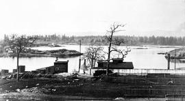
Victoria Upper Harbour

Unidentified couple, possibly Peter Steele's grandparents

"Woodlands" 138 Government Street

John and Mary Ann Dilworth
Map of the south-eastern districts of Vancouver Island
Map of the south-eastern districts of Vancouver Island

Government House, 1401 Rockland Avenue

Captain William Alexander Mouat

Fort Victoria

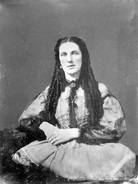
Sarah Steele ?

"Woodlands" 138 Government Street

James Fell, Mayor of Victoria 1886-1887

The "Birdcages", the first Legislative Buildings

Church Hill looking south west towards James Bay

Harbour from Government Street

Yates Street looking west from Government Street

Fort Victoria. To the left, Governor Douglas' headquarters, to the right the building used as a church and school

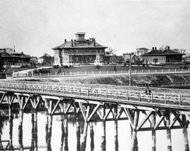
James Bay Bridge

Unidentified older man

Unidentified older woman

Sarah Steele ?
William Wilson fonds
William Wilson fonds
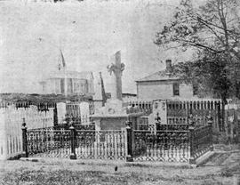
Corner of the Quadra Street Cemetery
Rout Harvey family fonds
Rout Harvey family fonds

The "lock-up", Bastion Square
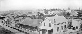
Panorama of Bastion Square and Wharf Street

Panorama of Bastion Square and Wharf Street
Miller family fonds
Miller family fonds

Esquimalt town

Fort Street, Mayor Thomas Harris on horseback

"Woodlands" 138 Government Street
City directories collection
City directories collection
Government administration buildings, "The Birdcages"
Mary Ann Richardson (nee Parker)
Plan of the Fairfield Farm Estate
Plan of the Fairfield Farm Estate
Haro Strait and Middle Channel
Haro Strait and Middle Channel

Town of Victoria, Vancouver Island, from the official map