62 results with digital objects
Show results with digital objects


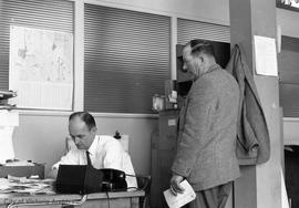
AC1-M09574
·
Item
·
[ca. 1912]
Part of Miscellanea collection


AC1-MAP-0201
·
Item
·
Jan. 1912
Part of Miscellanea collection
Location and size of water mains shown.

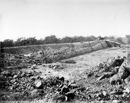
AC1-M07937
·
Item
·
18 Sep. 1908
Part of Miscellanea collection

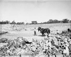
AC1-M07940
·
Item
·
1908
Part of Miscellanea collection

AC1-M07941
·
Item
·
1908
Part of Miscellanea collection

AC1-M07943
·
Item
·
1908
Part of Miscellanea collection
AC1-M07950
·
Item
·
1908
Part of Miscellanea collection

AC1-M07960
·
Item
·
1908
Part of Miscellanea collection
AC1-M07961
·
Item
·
1908
Part of Miscellanea collection

AC1-M07963
·
Item
·
1908
Part of Miscellanea collection

AC1-M10124
·
Item
·
1898
Part of Miscellanea collection

AC1-M10125
·
Item
·
1892
Part of Miscellanea collection
AC1-MAP-0034
·
Item
·
30 Jul. 1913
Part of Miscellanea collection
Shows streets, relief by contours, water supply pipes and hydrants.
AC1-MAP-0078
·
Item
·
14 Apr. 1916
Part of Miscellanea collection
Shows existing, proposed, and future mains for downtown area and along Yates and Fort Streets to water tower.
AC1-MAP-0093
·
Item
·
[1922?]
Part of Miscellanea collection
Water mains of the Esquimalt Water Works Company.
AC1-MAP-0122
·
Item
·
Dec. 1907
Part of Miscellanea collection
Shows location, acreage and capacity of various watersheds and locations of pipelines to Victoria.
AC1-MAP-0147
·
Item
·
Nov. 1939
Part of Miscellanea collection
Shows water supply lines. Contours added by hand.
AC1-MAP-0178
·
Item
·
[190-?]
Part of Miscellanea collection
Shows streets and drains in the Burnside and Victoria West Districts.
AC1-MAP-0179
·
Item
·
[190-?]
Part of Miscellanea collection
Map covers the Hillside-Quadra District and parts of the Oaklands and Burnside Districts. More drains shown than on the other maps of the same title (D0023).

AC1-M10126
·
Item
·
1901
Part of Miscellanea collection
AC1-MAP-0224
·
Item
·
[1851 or 1852]
Part of Miscellanea collection
Shows major structures, surveyed lots, and the site of a proposed reservoir. Highlighted by hand.
AC1-M08698
·
Item
·
[189-]
Part of Miscellanea collection


AC1-M08695
·
Item
·
1907
Part of Miscellanea collection

AC1-M07935
·
Item
·
1908
Part of Miscellanea collection

AC1-M07936
·
Item
·
1908
Part of Miscellanea collection

AC1-M07942
·
Item
·
1908
Part of Miscellanea collection

AC1-M07944
·
Item
·
1908
Part of Miscellanea collection

AC1-M07945
·
Item
·
1908
Part of Miscellanea collection

AC1-M07947
·
Item
·
1908
Part of Miscellanea collection

AC1-M07949
·
Item
·
1908
Part of Miscellanea collection

AC1-M07951
·
Item
·
1908
Part of Miscellanea collection

AC1-M07955
·
Item
·
1908
Part of Miscellanea collection

AC1-M07957
·
Item
·
1908
Part of Miscellanea collection
AC1-M07959
·
Item
·
1908
Part of Miscellanea collection
AC1-M07962
·
Item
·
1908
Part of Miscellanea collection

AC1-M07967
·
Item
·
1908
Part of Miscellanea collection

AC1-M07971
·
Item
·
1909
Part of Miscellanea collection

AC1-M08688
·
Item
·
1932
Part of Miscellanea collection

AC1-M08696
·
Item
Part of Miscellanea collection
AC1-MAP-0013
·
Item
·
Dec. 1907
Part of Miscellanea collection
Shows location, acreage and capacity of various watersheds and locations of pipelines to Victoria.
AC1-MAP-0097
·
Item
·
19 Aug. 1949
Part of Miscellanea collection
Water mains at intersections located and numbered. Boundaries of four sections of the city drawn. Information not plotted for Downtown and Victoria West.
AC1-MAP-0121
·
Item
·
[1905?]
Part of Miscellanea collection
Shows properties of Esquimalt Water Company on Goldstream, above B.C.E.R.R. Co.'s power house.