AC1-MAP-0147
·
Item
·
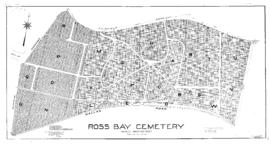
Nov. 1939
Part of Miscellanea collection
Shows water supply lines. Contours added by hand.